
Local Trails

Cowans Hill Trail
Walk, run, MTB. Dogs must be on a lead. E-Bikes are allowed but there are two stiles to lift over. Cell phone coverage.
Distance: 6.3 km from Tekapo Township
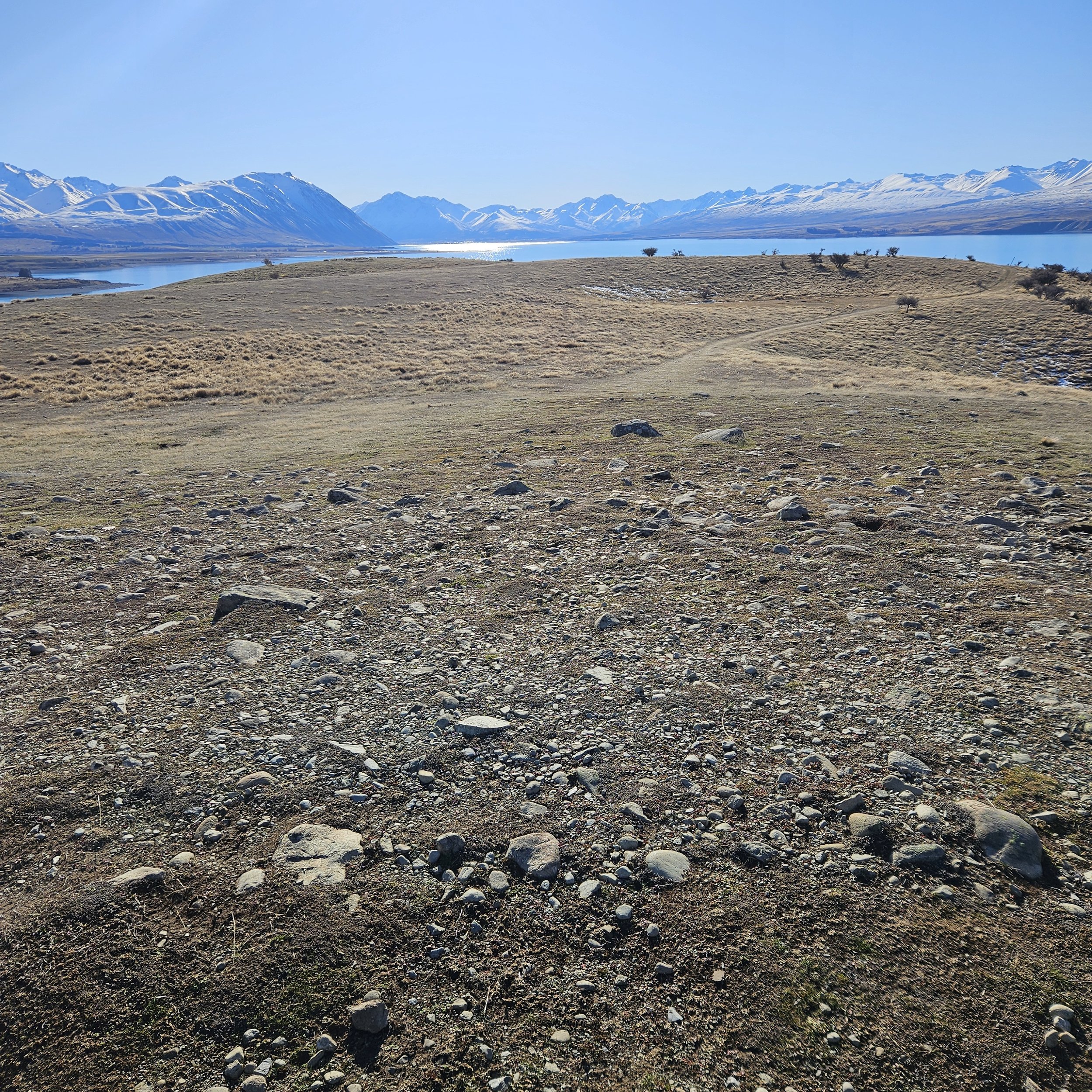
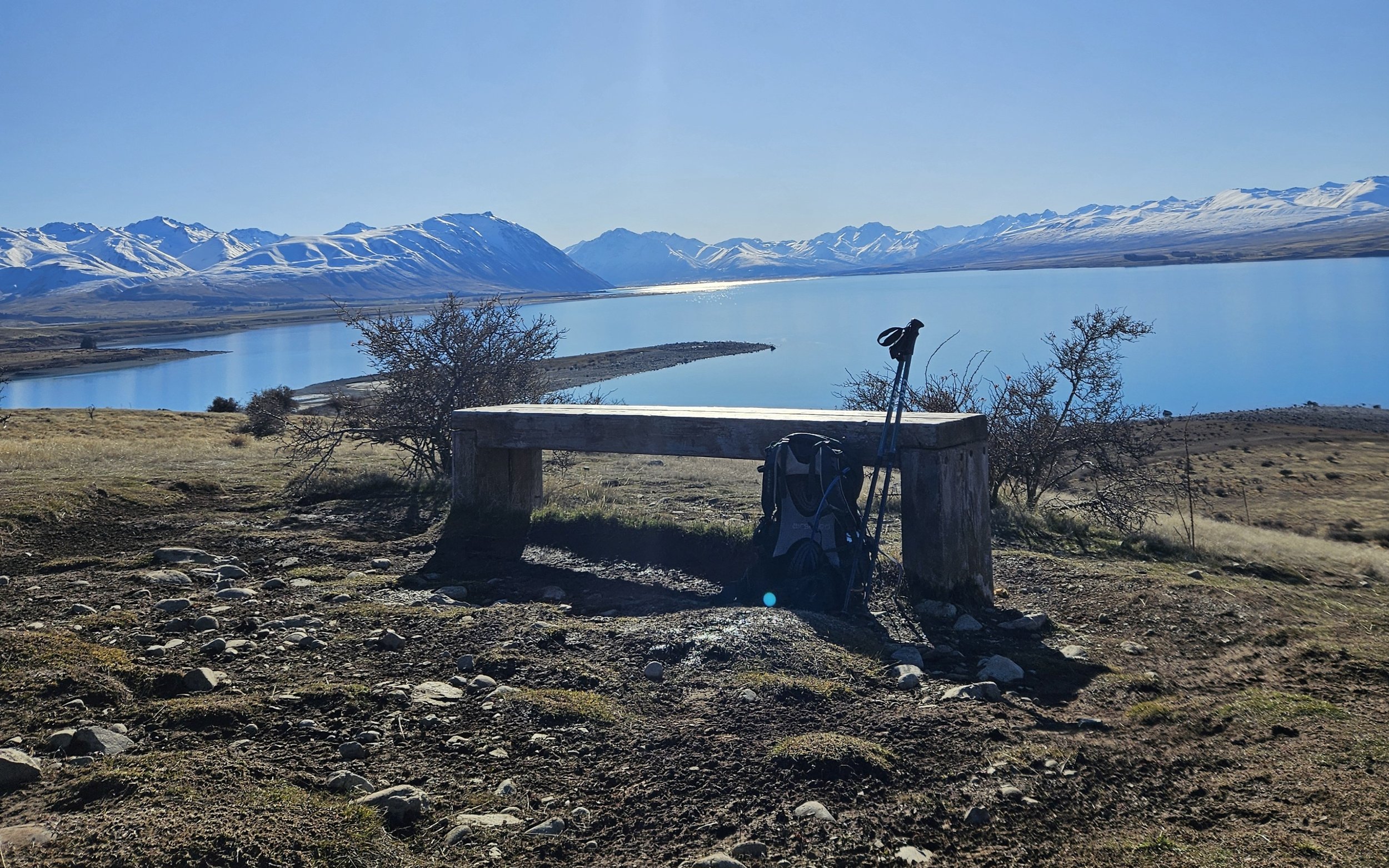
Description: A well-liked and simple hike or mountain bike ride offering great scenery of Mackenzie Basin with just 71 meters height difference. You'll pass through pine trees, grassy areas, ponds with chances to see the black stilt, Cowans Hill Observatory domes, cross SH8 to the Regional Park, and follow Tekapo Lakeshore. Pause at the bench on the trail's peak for panoramic views in all directions.
Getting there: Start from Tekapo town. Go east over the bridge on footpath. Right onto the path, find DoC sign. Walk to info panel by river. Follow path past homes into forest to stile. Cross to grassland, then to seat and another stile. Go left along road, see DoC sign. Cross SH8 to park. Head to Lilybank Rd on park tracks. Walk along lake to Tekapo town.
Make it stDiscover the unparalleled beauty of Tekapo Trails! Immerse yourself in the stunning landscapes of New Zealand as you traverse our world-class hiking and biking trails. From snow-capped mountains to crystal-clear lakes, Tekapo Trails offers an unforgettable outdoor experience for adventurers of all levels. Plan your next adventure with us and let the journey begin.and out.
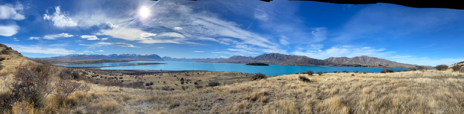
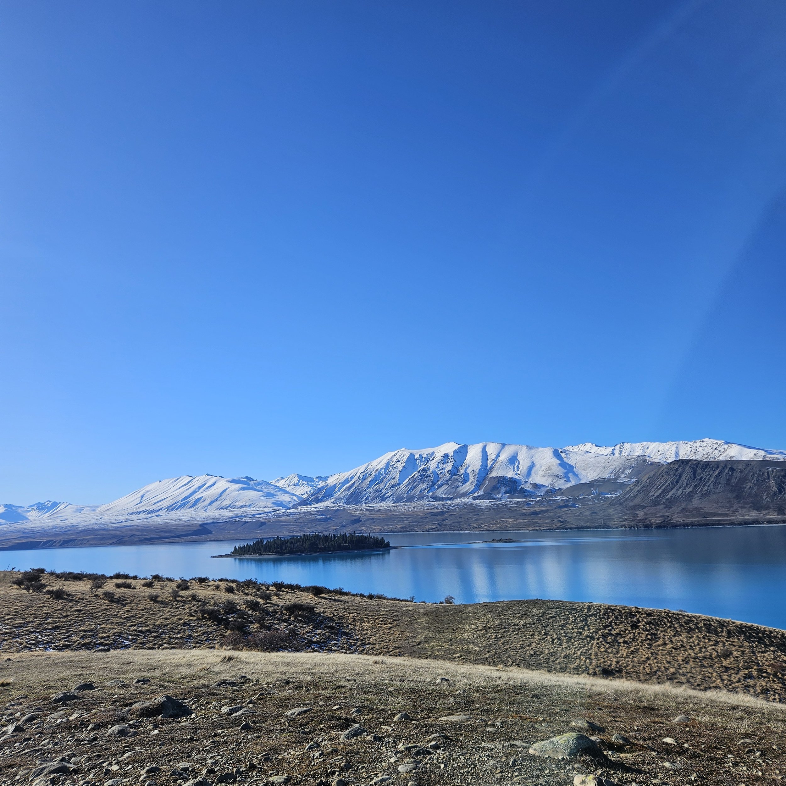
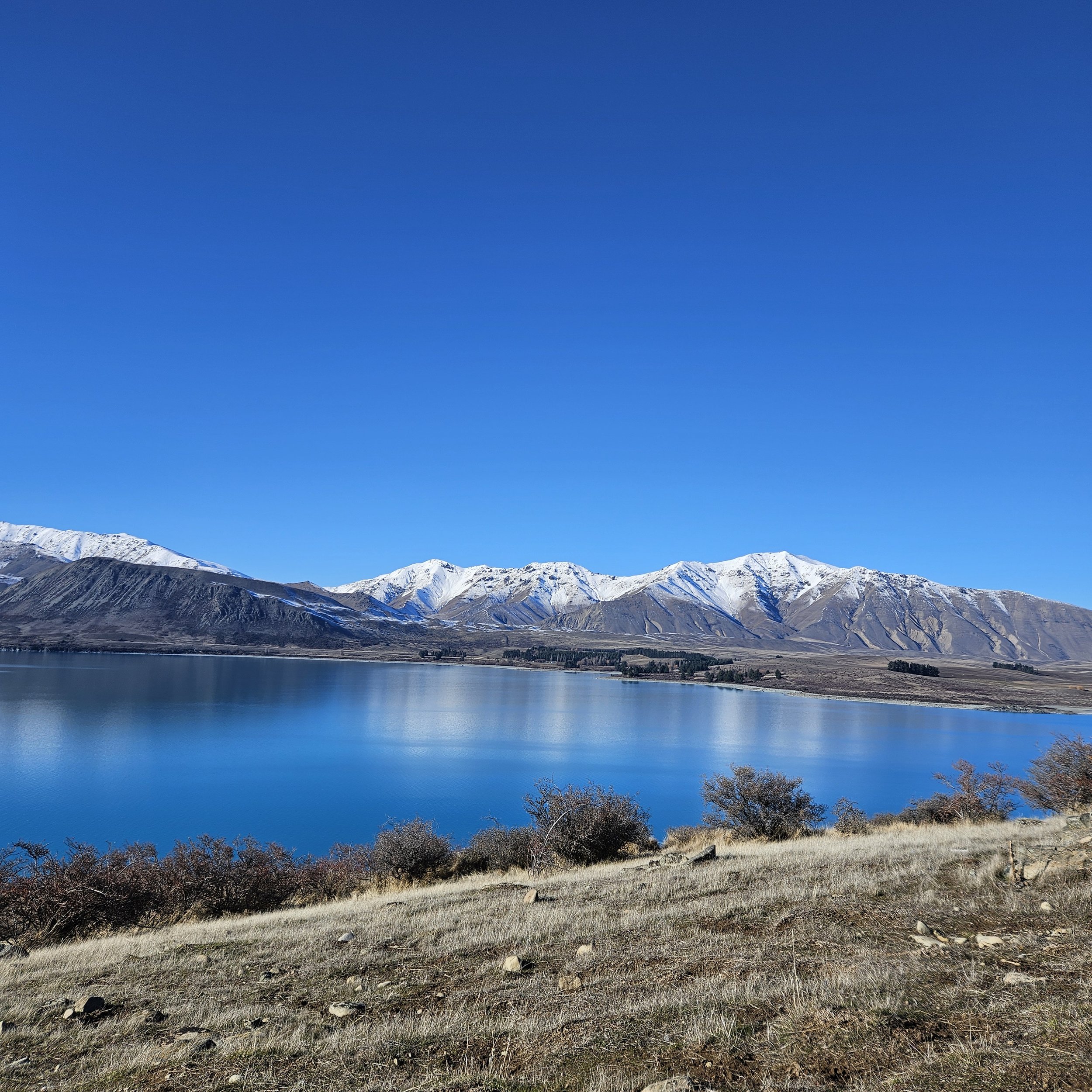
Cowans Hill, Lake Tekapo
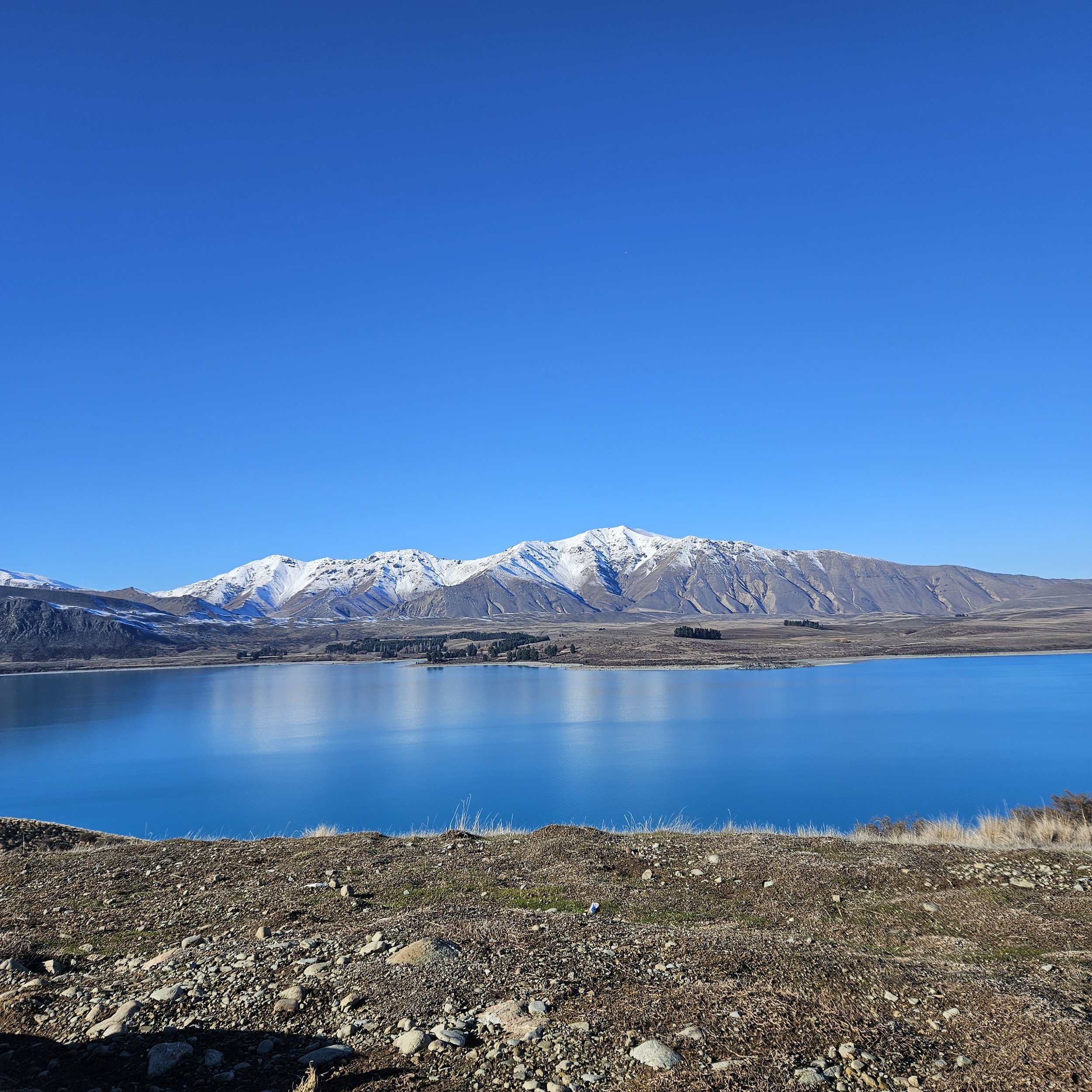
Overlooking the picturesque Lake Tekapo, Cowans Hill offers visitors a tranquil escape into nature's beauty. The short hike to the top rewards hikers with panoramic views of the stunning turquoise waters of the lake, framed by the majestic Southern Alps in the distance. Whether you're an avid hiker or simply seeking a peaceful spot to unwind, Cowans Hill is a must-visit destination. This walk offers amazing views of the Mackenzie Basin.
Tekapo Lakeshore Trails
Township to Pines Beach Trail
Walk, run or MTB (Grade 1-2).
Distance: 3.5 km one way
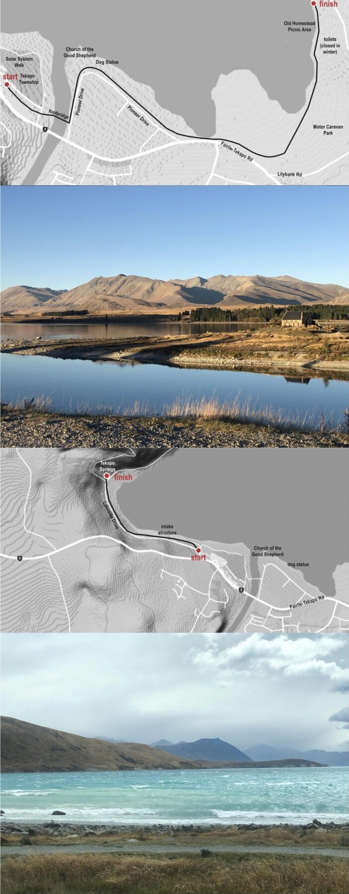
Description: The Lake Tekapo trail goes from town to Pines Beach, suitable for swimming and boating. It extends 1.9km to from the Old Homestead Carpark, where toilets are located. Please use toilets at Homestead Carpark, take your trash with you, and be respectful. When biking, you may want to use the road or lower track near the Dog Statue.
Getting there: From Tekapo Township, cross the footbridge and follow the lakeshore on the gravel path into the Regional Park. Return any which way and if you have small children there are plenty of places to rescue them with a vehicle when they won’t walk any further!
Township to Tekapo Springs
Walk, run or MTB (Grade 1-2).
Distance: 2.8 km one way
Description: This easy, flat and gravelled trail basically follows the Tekapo lakeshore from the Township to Tekapo Springs and the start of the Mt John Walkway.
Getting there: From Tekapo Town, walk to the supermarket. Go around the wooden fence to a gravel carpark and past Bespoke Cycles. Cross Lakeside Drive and take the gravel path alongside the lake. Use the crosswalk to a paved path and cross back to the lakefront near the motorcamp to finish.

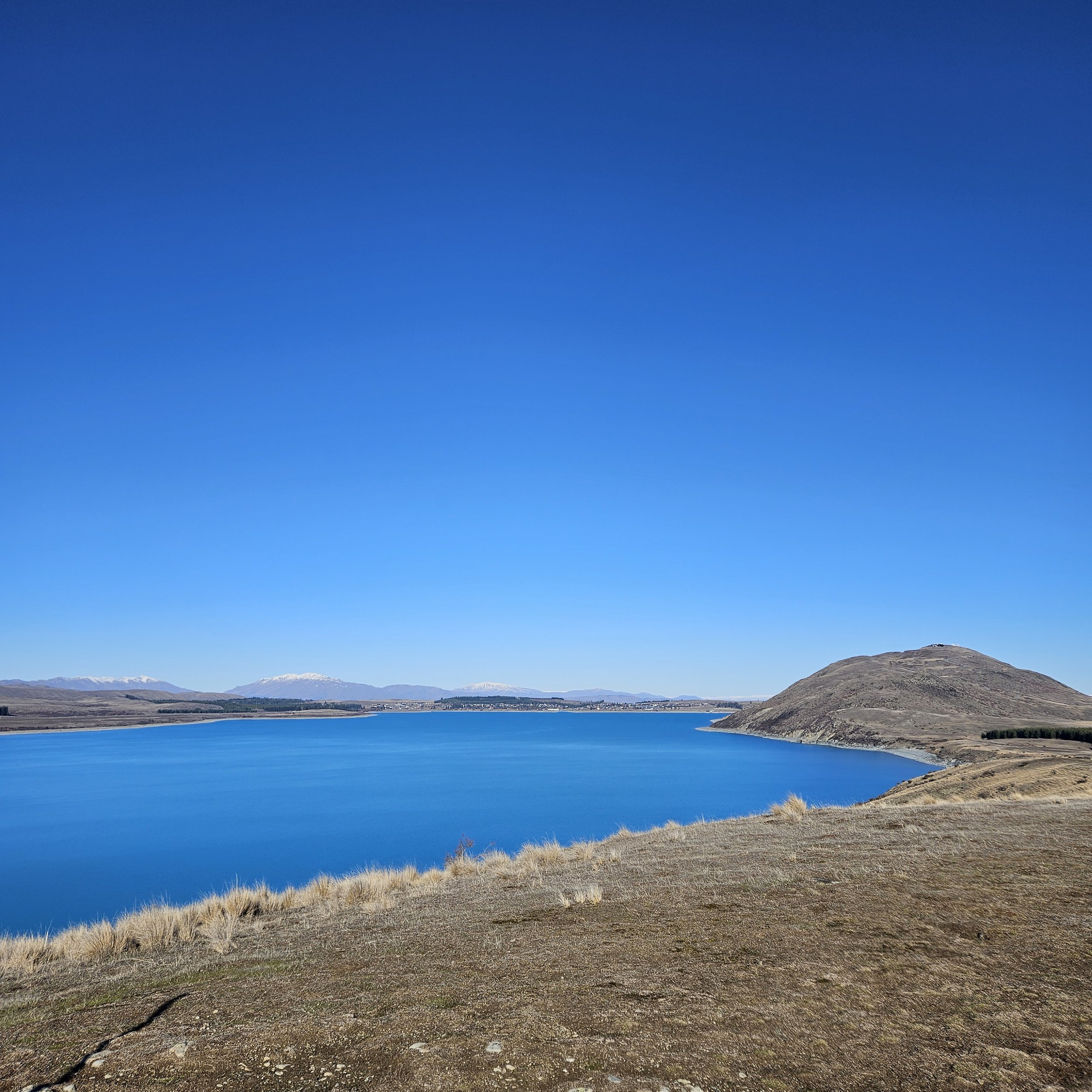
Peninsula Trail
Walk, run or MTB (Grade 2 -3).
Distance: 5.6 km
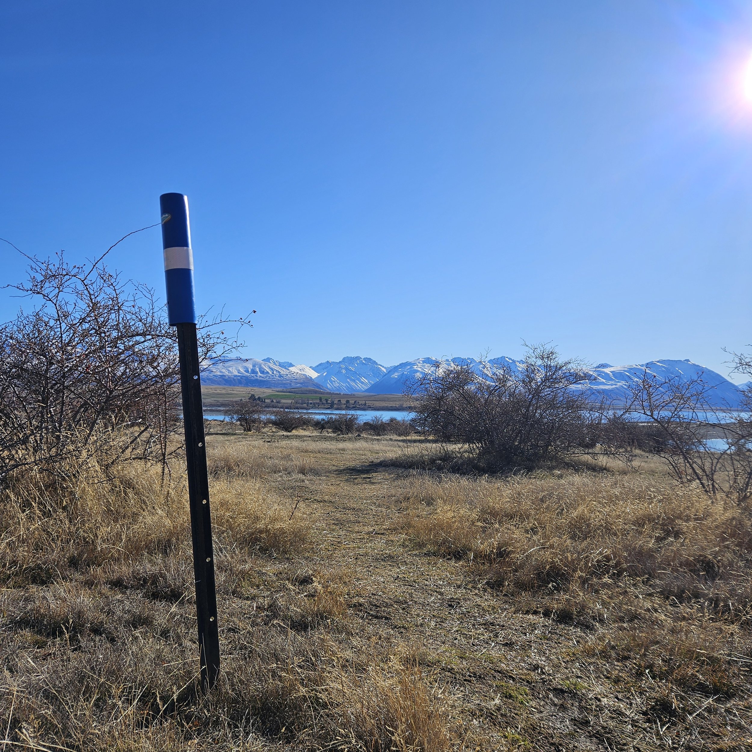
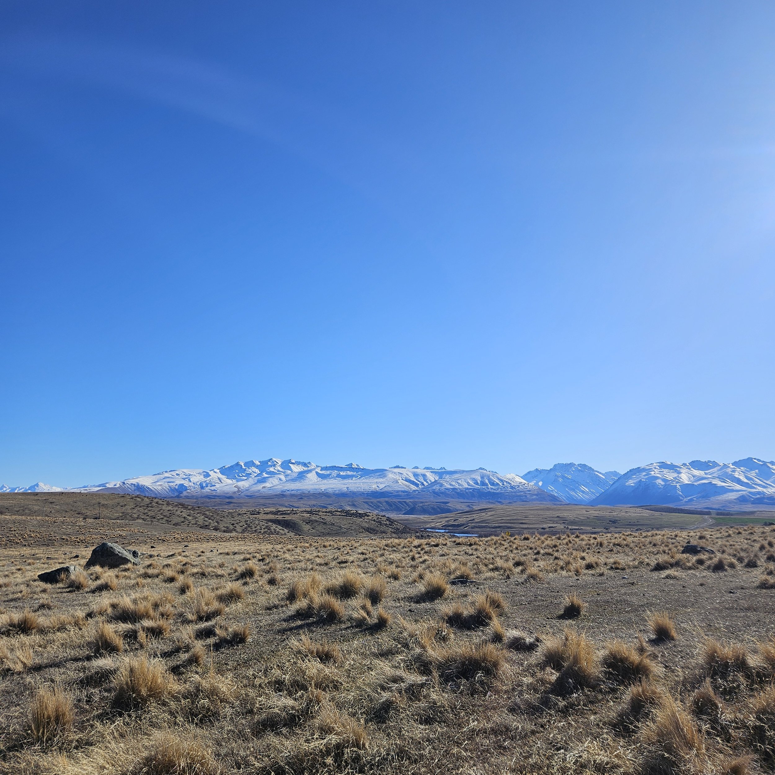
Description: This easy, popular circuit offers beautiful views of Lake Tekapo and Lake McGregor from a very different angle to what you see from Tekapo township. It is a DoC track marked with orange poles but sometimes a little hard to find amongst the rosehips so look carefully. At the northern point it is worth walking down to the lakeshore (dotted line) and turning south for a short way to get a closeup view of the white cliffs you look across at from Lilybank Rd. Their chalky texture are very striking in the morning sun. This is unmarked so just climb down the bank where it is low and easy. The trail is open all the way. You must use the public toilets in Tekapo before you venture out. All rubbish must be taken out. Leave no trace.
Closed for lambing mid-October to mid-December.
No dogs, no exceptions.
If MTBiking, it is advisable to take the right hand fork but take care on the steep descents. If going in the opposite direction, you may have to push your bike on two short uphill sections.
Getting there: From Tekapo Township, travel west and turn right onto Godley Peaks Rd.
Drive 5.7 km to a small carpark on your right.

Mt John Walkway
Walk, run. Dogs on a lead. Cell phone coverage.
Bikes on 4WD track on lakeshore only. Bikes on 4WD track on lakeshore only.
Distances:
Mt John Walkway Circuit ,8.5 km
Tekapo Springs to Mt John Summit – 1.5 km
Tekapo Springs to South Summit Circuit – 2.8 km
Description: This trail is uphill all the way to the top but many zigzags make it possible for most people. The first part of the trail is through the trees to a seat overlooking the lake. Continue through the small gate, until you come out into the open. Pass another seat and either take the trail on the right to the South Summit or continue over the stile on the Mt John Walkway. A side trail marked on the right will take you to the Astro Café on the summit, or continue on the loop, crossing the road until another stile. From here follow the well worn track down the ridge and complete the circuit back to Tekapo Springs.
The circuit can be undertaken in either direction but local advice is to go clockwise and enjoy the expansive views as you head down the Mt John ridge and return along the lakeshore.
Getting there: Walking - from the Tekapo township, walk following the lake behind the supermarket and onto a concrete path. Follow this path to the start of the trail on your left just before Tekapo Springs
Driving - drive west not far on SH8 and turn right onto Lakeside Drive. The trail starts on the left before Tekapo Springs. Car-parking is available close to the trail at the end of the road.